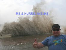
Yesterday's Reflection, Today's Despair, Tomorrow's Hope.
 So much for my forecast yesterday. It appears the jet max remained up in Oklahoma (keeping everything south of the Red River subsident) as the upper vortex spun more up towards Nebraska than Kansas. This along with the morning clouds and rain reduced the dryline punch into better moisture. At least I busted in good company with the SPC's 20Z tornado threat risk from yesterday as well as the moderate risk that straddled the Red River Valley. I truly thought I'd intercept a cell near the I-35 corridor south of the Red River and track it eastward. Oh well....the N TX curse. What can I say?
I did catch the one big cell that tracked across S OK that had a persitent tornado warning as it got into SE OK along with a couple of confirmed reports. I saw several very ominous wall clouds and great structure. However, I never seemed to be able to get out of the creek bottoms and trees to get pics of the better structure before it would morph into something more mediocre as I got into a clearing. The storm was taunting me. ;-) I did capture a few decent lightning shots which I'll post later.
For the rest of today, I don't like what I'm seeing on the model runs. Current surface analysis supports the model solutions of low level winds veering throughout the day as well as being on the southern side of mid level jet (an all too common theme for N TX and S OK). It looks like hot, windy and dry for any chasing within my range today.
Attention turns to tomorrow as a cold front merges with the dryline and eases southeastward across the area and a pronounced RRQ of mid and upper jets establishes itself across the area along with ample moisture, instability, and veering profiles. It looks more like a strong to severe squall line event at this time, but it needs to be watched carefully since the models, as usual, are struggling even 24 hours out with systems.
Congrats to my homie Steve Miller of Tulsa who pretty much nailed Hugo as a target yesterday as the big tornadic cell tracked only a few miles north of there. And to think that *some* people out there claim he doesn't know how to forecast. ;-)


0 Comments:
Post a Comment
<< Home