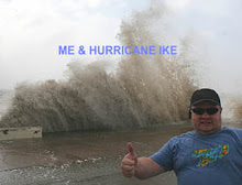
Look...up in the sky...it's...

Anyway, it was a pretty good thunderstorm as an added bonus with nice special effects. ;-) A severe thunderstorm warning was issued for it because of 60mph winds. I didn't get that, but I heard a few trees were down not too far to my west. I received about 1/2 inch with areas to my west by about 3 miles getting a good drenching of an inch or more. At least I can go another week without watering the yard.
Perhaps another shot tomorrow, but I'm not holding my breath. Today was a freakish anomaly. You know, I don't mind Texas summers that much after living here all of my life. We at least typically get a good drenching up into May and even parts of June to get us through. But, this spring and summer I'll be ready to bid farewell to one of the most hellish summers I've ever experienced. I can start to see September in the near distance which will at least serve as a benchmark that summer is on it's last leg.
I'm ready for a long, cold winter. It seems to me that there is a correlation with really cold winters followed by a very active severe weather season. We have certainly seen the opposite of that with very warm winters followed by dry and inactive springs. Rich Thompson of the SPC has surmised that colder temperatures out over the GOM serve to pickup tons more moisture. It's the same principle of those cold early fall mornings where you see tons of fog over the warmer bodies of lakes. Of course, you don't want it brutally cold either to severely drop the GOM sea surface temparatures excessively.
Last year, cold air never made it out over the GOM basin and surrounding Caribbean and western Atlantic waters. The result of course was an abundance of drier air across this part of the world. Again this is based on what I read from Rich Thompson. I certainly agree with that. It is something that I believe isn't being looked at too closely by climatologists and most people in general....at least I never see or hear it being discussed. I wish I had the time to do an anlysis of the 1930's Dust Bowl era and compare that to the past couple of years. Just analyzing surface charts I think would be very interesting...especially since upper air data was relegated only to pilot reports back then.
We have to have something to really shake up the atmosphere on this side of the equator. A brutal winter just might be what is needed.


0 Comments:
Post a Comment
<< Home