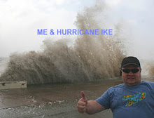
Today's Outlook - 10/11/08
This is a good time to point out one of the major problems with fall storm systems....warm mid level temperatures. Throughout the summer, all of that convection around the globe aides in really warming up the atmosphere. When the cooler surface temps arrive in the fall, the mid levels of the atmosphere are much slower to respond to the decreasing sun angle. The result is a a 180-degree reversal of the thermodynamic profiles we enjoy in the spring and early summer. Then, the mid levels have cooled off from winter and the surface temps start increasing rapidly thus outpacing the mid level response.
So, it is no surprise then to see the forecast models indicate rather pitiful instability forecasts regarding the current system impenging on the plains. A look at the upper air soundings reveal 500mb temps from -7 to -10C across NM and the W parts of TX. Heck, even Denver is only -12C. With surface temps only expected in the 70's today with lots of cloud cover and elevated showers, the resultant lapse rates will be pitiful and meager instability remaining below 1000j/kg....and we'll be lucky to see even 500j/kg. If the model forecasts are correct in further increasing the mid level temps as heights increase, the surface based instability will practically be non-existent. Elevated instability will be there, but that too will be meager. It's enough though to pop off some weak elevated convection.
With a lack of any surface convergence even into E NM, I just don't see how any surface-based storms will form today in E NM or western parts of Texas in my "chase radius". With the extensive moisture pouring into the area at the mid and upper levels from Hurricane Norbert from the Baja region, combined with impulses in the upper levels, we are only going to see alot of light/moderate rain and a few heavier showers with isolated embedded thunder. Definitely NOT a good day for stormchasing. Being the eternal optimist though, I'll keep checking on things though just in case we get a good break in the cloudiness and something very close to home pops up. Hmmm....maybe that's more as a delusional SDS patient than an eternal optimist. LOL!!
Tomorrow, things might be a slight tad better as we should see some surface convergence and perhaps a bit more insolation. More on that tomorrow morning though. :-)


0 Comments:
Post a Comment
<< Home